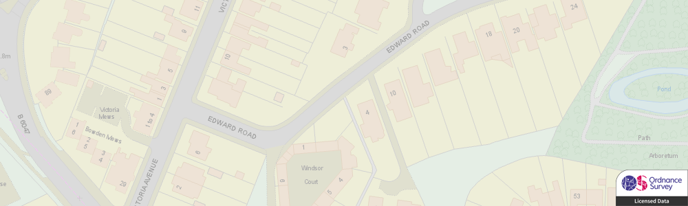
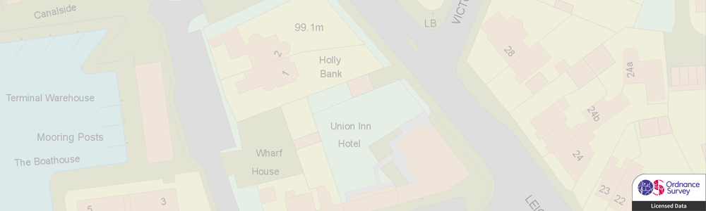
OS MasterMap Topography Layer
The OS MasterMap® Topography Layer is the most detailed, current and accurate mapping dataset of Great Britain. The data includes detailed buildings, roads, paths, railways, woodland, natural and heritage features, inland and tidal water, point features and cartographic symbols and text.
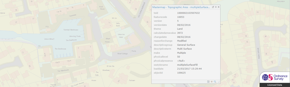
MasterMap topography layer can be used to build a detailed background map, for planning and construction, and for detailed spatial analysis. The unique topographic identifiers (TOIDs) for features can be used to link data across products, including you own data, such as assets, properties and land.
We can supply MasterMap topography data in most major formats and for the coverage you require, from a small area to full UK coverage. We can also provide change-only updates on a regular schedule to ensure you always have the most current information.
| Type | Vector – Points, Lines, Polygons, Text |
| Layers | Topographic Areas, Landform Areas, Topographic Lines, Boundary Lines, Topographic Points, Cartographic Symbols, Cartographic Text |
| Scale | 1:1,250 to 1:10,000 |
| Coverage | Full GB or your area of interest |
| Update Frequency | 6 weekly |
| Formats Available | GML, Esri Shapefile, Esri File Geodatabase, MapInfo TAB, PostGIS, Others |
| Pricing | Dependent on coverage and intended use. |
| Licensing | Annual License Required. |
Related Products
Related Services
GIS Database Design & Loading
GIS4BUSINESS can help with designing spatial databases and modelling spatial data to ensure that the design is tailored to intended use cases and performance is not compromised.