GIS Data Conversion & Loading
A wide variety of commercial and open GIS datasets are now available from a range of sources. These datasets are often provided in formats that are not readily useable out of the box and require GIS data conversion and loading to work with your own database or data store. This means handling the conversion, loading and update of GIS datasets can consume many hours of support and maintenance effort and diverts resources from their core roles.
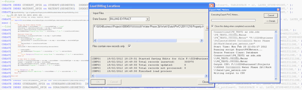
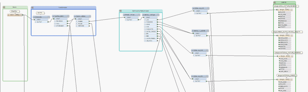
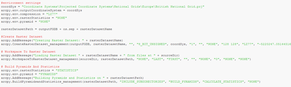
GIS4BUSINESS can simplify the maintenance of your data by undertaking GIS data conversion to translate these datasets into the native format that is required by your software or database. We can also assist you with loading almost any format of GIS data directly into your database and can put in place processes to simplify regular updates to the data.
Often there is a requirement to extract data from your own database to provide to contractors or other external organisations in a specific format. We can assist with one-off GIS data conversion or can help put in place automated data extract processes so that time is not wasted manually extracting data.
We can also geo-code non-spatial data such as customer addresses and postcodes and can geo-reference CAD or aerial images so that this data can be visualised on a map.
Related
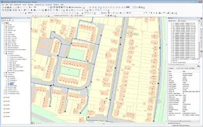
Water Utility GIS Updates
Competition for business customers within the water industry and the separation of the retail and wholesale business required that Severn Trent Water implement GIS updates to handle non-household customers differently.
Corporate Address Management
GIS4BUSINESS were involved in design, development and implementation of changes to existing systems, including GIS, during the implementation of a corporate address management solution at Severn Trent Water.
AddressBase Premium Migration
Migration to OS AddressBase Premium represented a significant change. GIS4BUSINESS undertook the design and development of required changes to the existing database schema and custom gazetteer tools within Portsmouth Water’s enterprise Esri GIS solution.
STW Desktop GIS Upgrade
GIS4BUSINESS provided GIS consultancy to Severn Trent Water during a desktop GIS upgrade to an existing Esri solution, producing designs, applying database changes and developing data migration processes as part of the upgrade.
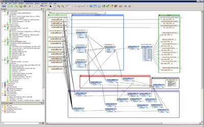
Utility GIS Migration
GIS4BUSINESS completed the migration of an existing Esri ArcGIS 9.2 system to version 10.1 for Brookfield Utilities, a multi-utility client that install and manage gas, electricity, water and fibre networks.
GIS Platform Installation & Configuration
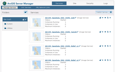
AECOM were interested in building a GIS platform that would become a future corporate GIS portal. GIS4BUSINESS were asked to assist by reviewing the configuration, recommending changes and improvements to ensure best practice.
3D Data Import to CAD using FME
GIS4BUSINESS developed an automated import process using FME to load 3D point data representing various monitoring equipment, in use on a section of the Crossrail engineering project, from an excel file into a template AutoCAD DWG file.
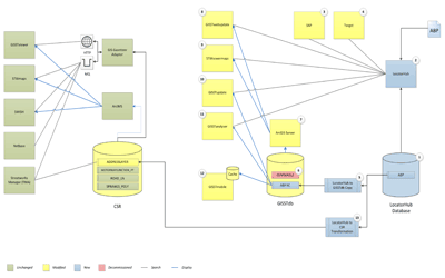
Legacy GIS Replacement
GIS4BUSINESS assisted Severn Trent Water during the delivery of a major GIS replacement project, replacing a legacy Esri asset update system with an enterprise Esri ArcGIS and ArcFM solution.
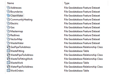
Utility GIS Improvements
A detailed review was undertaken by GIS4BUSINESS of the state of Portsmouth Water's GIS and asset data. GIS improvements were implemented and have enabled Portsmouth Water to exploit GIS data and integrate GIS with other systems.