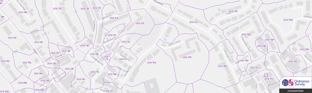
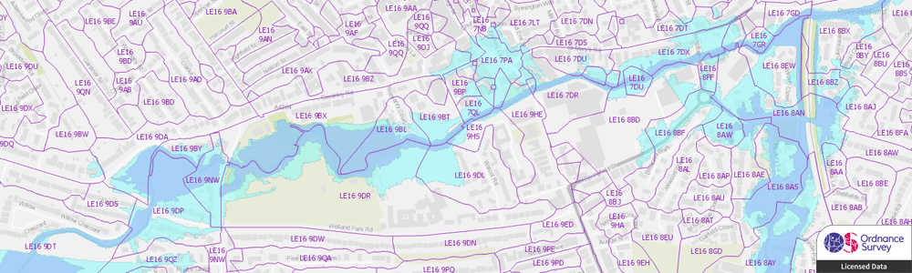
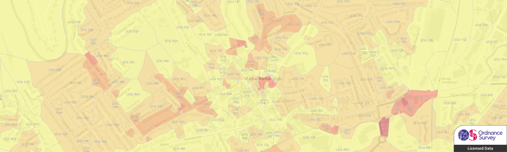
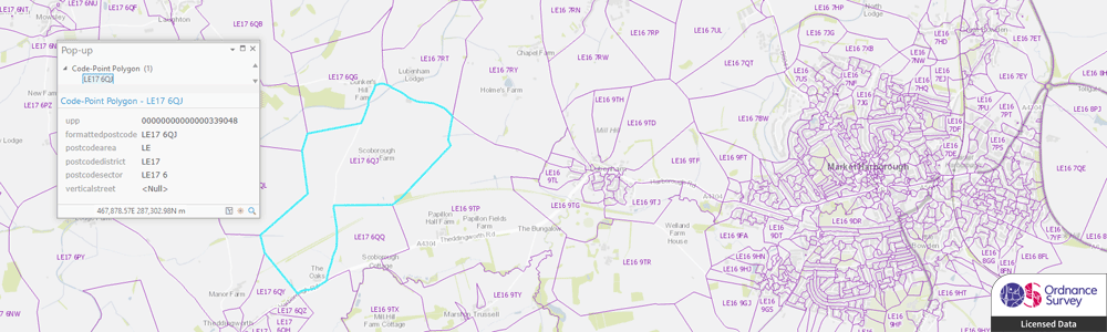
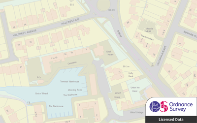
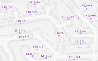
OS Code-Point with Polygons
The OS Code-Point® with Polygons dataset includes point locations of all postcodes in Great Britain and notional postcode boundary polygons, enabling better visualisation and analysis of your postcode related data.
Whether you need to visualise customer demographics, property, health or crime information or have a requirement to analyse risk information, such as flooding, and subsidence, Code-Point with Polygons enables more advanced analysis and decision-making.
We can supply Code-Point with Polygons data in most major formats. We can also provide updates on a regular schedule to ensure you always have the most current information.
GIS4BUSINESS can also assist with bespoke geographic data analysis that incorporates postcode information and can provide derived data and reports, such as flood risk for postcodes. We can also provide derived postcode sector, district and area polygons if required. Please feel free to talk to us about your specific requirements.
| Type | Vector – Points, Polygons, Tabular |
| Layers | Postcode Points, Postcode Polygons, Vertical Streets (Table), Discards (Table) |
| Scale | Up to 1:1,250 |
| Coverage | Full GB or your area of interest |
| Update Frequency | Quarterly |
| Formats Available | Esri Shapefile, Esri File Geodatabase, MapInfo TAB, PostGIS, Others |
| Pricing | Dependent on coverage and intended use. |
| Licensing | Annual License Required. |
| User Guide & Specification | Download |
Related Products
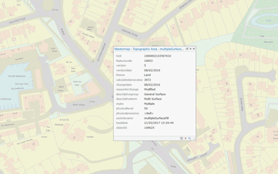
OS MasterMap Topography Layer
The OS MasterMap Topography Layer is the most detailed, current and accurate mapping dataset of Great Britain. The data includes detailed buildings, roads, paths, railways, woodland, natural and heritage features, inland and tidal water, point features and cartographic symbols and text.
OS Open Map Local
OS Open Map Local is the most detailed street-level open data product currently available from Ordnance Survey. The data includes roads, buildings, railways, hydrology, woodland and cartographic text, making it a great option for map backgrounds and spatial analysis.
OS VectorMap District
OS VectorMap District provides contextual mapping and background reference data, including roads, buildings, railways, hydrology, woodland and place names, making it a great option for map backgrounds and reference data.
OS Open Names
The OS Open Names dataset contains point locations for settlements, roads and postcodes in the UK, along with names and basic contextual information. It can be used in spatial analysis or for building basic gazetteer search and geocoding functionality.
OS Code-Point Open
OS Code-Point Open contains points representing locations of UK Postcodes along with basic contextual information. GIS4BUSINESS has enhanced the original dataset by providing formatted (single spaced) postcode, postcode area, district and sector attributes.
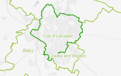
OS Boundary-Line
The OS Boundary-Line dataset contains details of administrative boundaries for England, Scotland and Wales, including counties, districts, boroughs, wards and parishes. The boundaries can be used in combination with a range of government statistical data to perform analysis.
Related Services
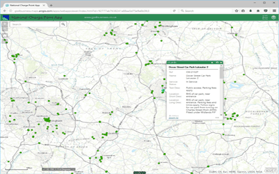
Routing & Network Analysis
Solving network related problems can be complex, such as finding the fastest route between locations, calculating service areas or tracing connected assets. GIS provides answers to these network analysis problems and can communicate the results in a compelling way through maps.
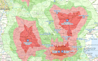
Multi-Criteria Evaluation
Many geographical business decisions are based on multiple factors. For example, the optimum location for a new site may depend on the density of customers, distance from competitors and the current land use. One of the key benefits of GIS is their ability to integrate, analyse and overlay different spatial datasets to facilitate informed decision-making.
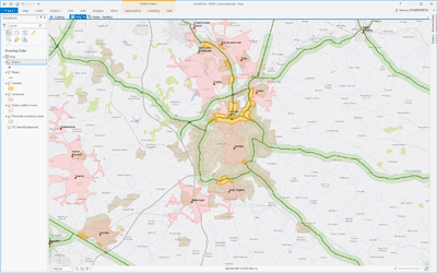
Map Production & Reporting
Using specialist GIS software, GIS4BUSINESS can produce well-designed, professional maps and reports. We can produce single site plan, a whole series of maps, or a report that provides answers to complex spatial problems. We can also deliver maps and reports in digital format or as an interactive web map.
Data Maintenance
Our GIS experts can maintain your GIS data on your behalf, including Ordnance Survey and other third-party data. We can apply regular updates to ensure that your applications have up-to-date maps and reference information, reducing the risk of incorrect decisions that are based on out-of-date information.
GIS & Map Data Supply
GIS4BUSINESS can supply a range of GIS and map data from a variety of sources, including Ordnance Survey licensed and open data products, OpenStreetMap and other recognised data providers.
GIS Data Management & Hosting
GIS4BUSINESS has the knowledge and experience to manage your GIS data for you so that specialist skills are not required in-house. We can support and maintain your geo-databases, manage regular updates or host your GIS data, services and applications in the cloud.