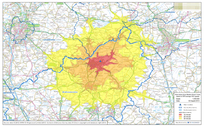
NHS Drive-time Analysis
NHS
May 2011 – Aug 2011
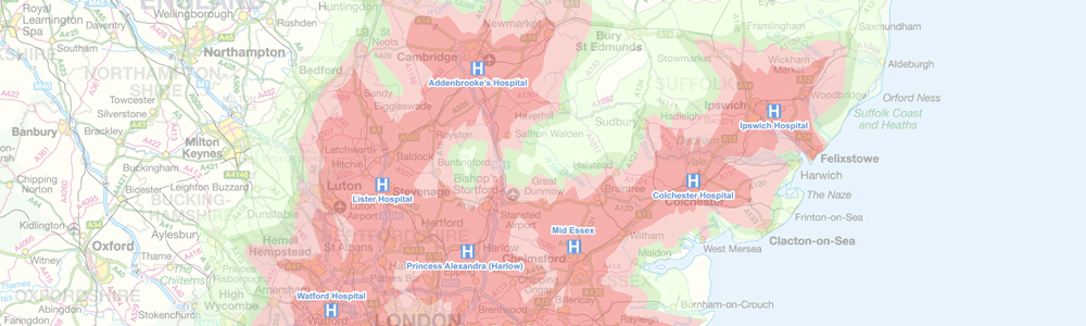
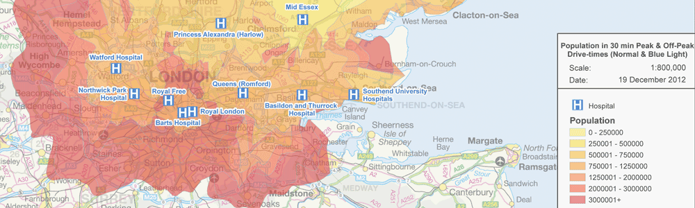
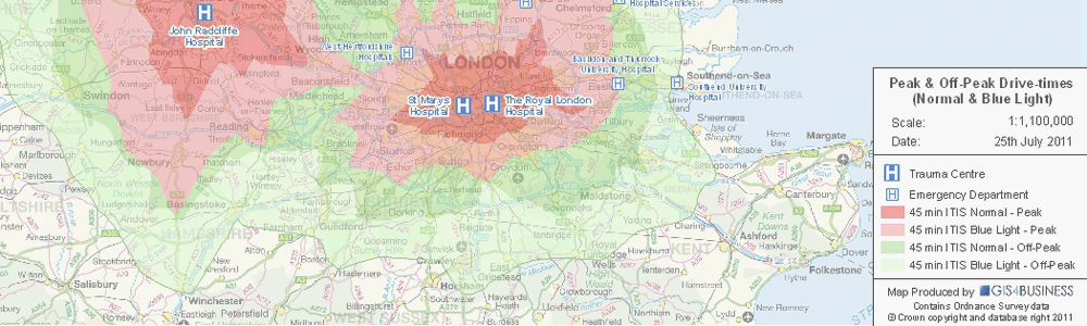
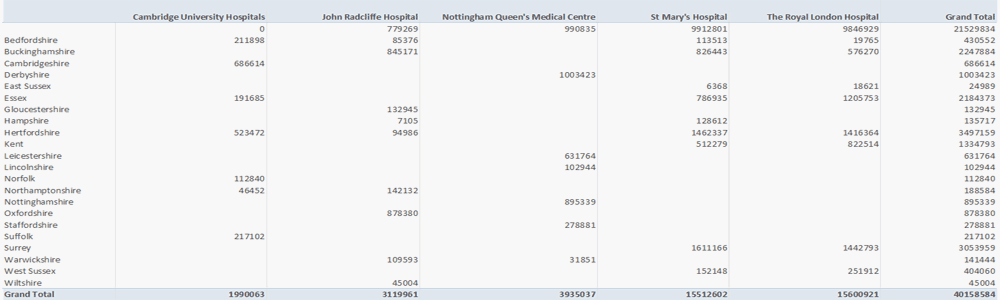
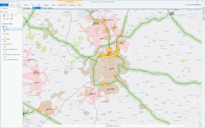
GIS4BUSINESS were asked to undertake drive-time analysis and produce maps and associated population data for several NHS trauma centres in the East of England.
Drive-time analysis was undertaken for each trauma centre in the East of England using Navteq street data. The analysis work involved:
- Generation of peak and off-peak drive-time isochrones using basic road speeds.
- Generation of peak and off-peak drive-time isochrones using INRIX GPS based average road speeds.
- Generation of peak and off-peak drive-time isochrones using estimated blue-light speeds.
- Calculation of population statistics using spatial analysis for individual drive-times and for the areas of overlap between drive-times.
- Production of a series of high resolution PDF maps showing the drive-times against Ordnance Survey background data.
- Supply of the resulting drive-time polygons in Esri shapefile format for incorporation into NHS own systems and reports.
The analysis completed by GIS4BUSINESS enabled NHS East of England to better visualise estimated trauma response times and help aid future planning and decision making, especially with regards to which trauma centre is best placed to respond to an incident.
Related Projects
Service Area Analysis
GIS4BUSINESS assisted an environment and transport consultancy with several site selection projects for local authority customers, undertaking GIS-based drive-time and service area analysis to find optimal locations for refuse sites.
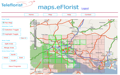
Retail Delivery Area Management
GIS4BUSINESS worked closely with eflorist to design and develop a web-based mapping application to enable franchised retail outlets to map their delivery areas, postcodes and rates and to gain greater insight into their network.
Mapping & Crime Analysis
GIS4BUSINESS provided consultancy and development expertise to Thames Valley Police during implementation of mapping and address data updates to internal systems and assisted with improvements to crime analysis, geo-coding and mapping.
Related Products & Services
Routing & Network Analysis
Solving network related problems can be complex, such as finding the fastest route between locations, calculating service areas or tracing connected assets. GIS provides answers to these network analysis problems and can communicate the results in a compelling way through maps.
Multi-Criteria Evaluation
Many geographical business decisions are based on multiple factors. For example, the optimum location for a new site may depend on the density of customers, distance from competitors and the current land use. One of the key benefits of GIS is their ability to integrate, analyse and overlay different spatial datasets to facilitate informed decision-making.

Map Production & Reporting
Using specialist GIS software, GIS4BUSINESS can produce well-designed, professional maps and reports. We can produce single site plan, a whole series of maps, or a report that provides answers to complex spatial problems. We can also deliver maps and reports in digital format or as an interactive web map.