Water Utility GIS Strategy
Portsmouth Water
Jul 2015 – Sep 2015
GIS4BUSINESS were asked to assist Portsmouth Water with defining and documenting a long-term high-level GIS strategy that will drive future improvements, integration and exploitation of GIS within the business.
GIS4BUSINESS produced a high-level GIS strategy document, based on an initial workshop with key stakeholders, but also referring to GIS and utility industry best practice.
The strategy document covered some of the following areas:
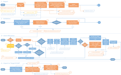
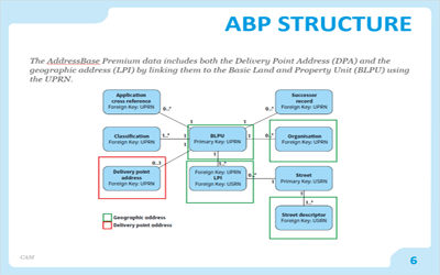
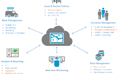
- Data management, including data capture, data quality improvement, data security, new connections and address data management.
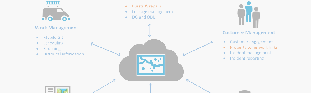
- Data delivery and presentation, including interactive map delivery, application integration, mobile GIS, incident management and customer engagement.
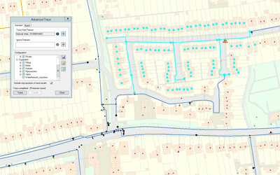
- Data analysis and reporting, including leakage analysis, water quality analysis and emergency planning.
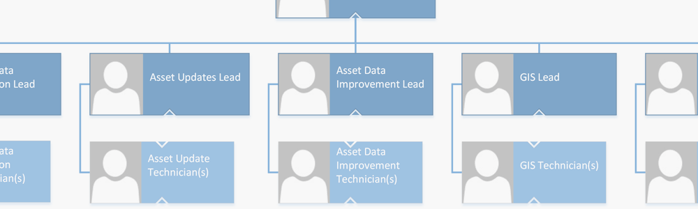
- Business structure and resource requirements for asset data management and GIS teams.
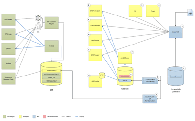
- Technology and infrastructure, including supporting IT infrastructure and security.
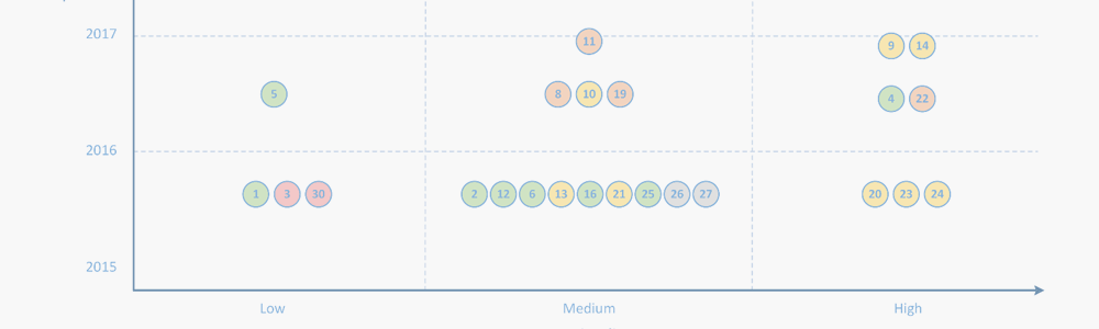
The document represented a high-level view of the proposed GIS strategy over the next five years and drilled down into specific areas that Portsmouth Water had raised as being of particular importance.
“Portsmouth Water has been engaged with GIS4BUSINESS in developing our use of GIS across a number of business areas for 8 years. They have carried out regular support and have delivered bespoke developments, including an interface for a mobile works order ERP solution. The GIS4BUSINESS approach is to provide reliable, friendly advice and timely, successful GIS solutions delivered to the satisfaction of PWL.”
Related Projects
Water Utility GIS Updates
Competition for business customers within the water industry and the separation of the retail and wholesale business required that Severn Trent Water implement GIS updates to handle non-household customers differently.
Corporate Address Management
GIS4BUSINESS were involved in design, development and implementation of changes to existing systems, including GIS, during the implementation of a corporate address management solution at Severn Trent Water.
Utility GIS Improvements
A detailed review was undertaken by GIS4BUSINESS of the state of Portsmouth Water's GIS and asset data. GIS improvements were implemented and have enabled Portsmouth Water to exploit GIS data and integrate GIS with other systems.
Related Products & Services
Tailored GIS Training
GIS4BUSINESS provide tailored end-user GIS training on-site to small groups or one-to-one. We also offer detailed technical training and documentation covering the various components of the GIS solution for system administrators.
GIS Strategy & Feasibility
A coherent and achievable future strategy for geographic information can enable organisations to successfully implement and fully exploit location within their operations.