Water Utility GIS Support
Portsmouth Water
2011 – ongoing
GIS4BUSINESS has provided GIS support to Portsmouth Water since 2011, covering an Esri-based solution that includes:
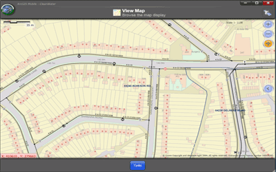
- ArcGIS Desktop including desktop customisations;
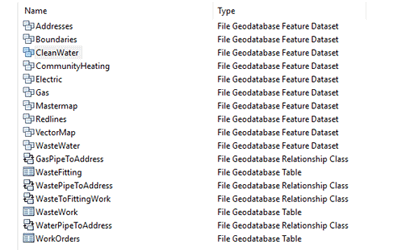
- Asset and third-party data held in several enterprise SDE geodatabases in a SQL Server database.
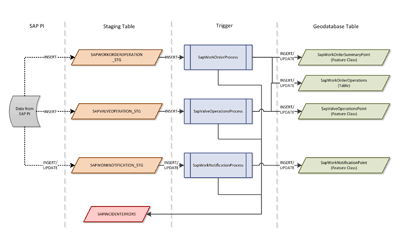
Following a recent project to integrate GIS with IFS, a new work management and financial system, the GIS support agreement has been extended to cover:
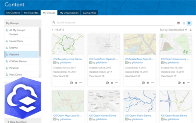
- ArcGIS Server including map, feature and geoprocessing services;
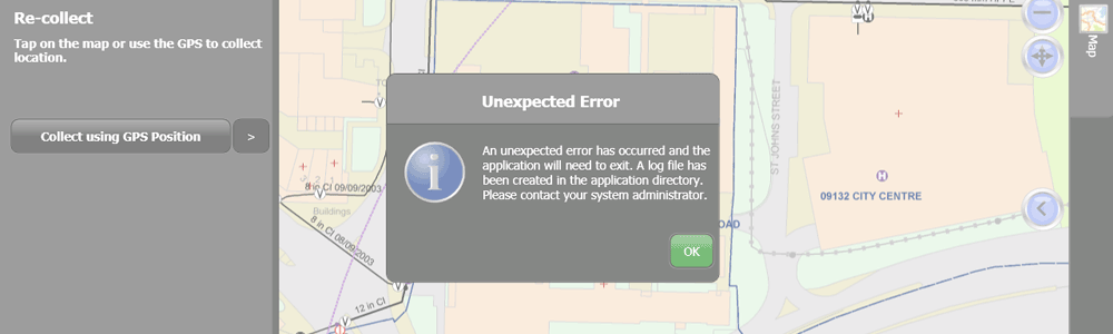
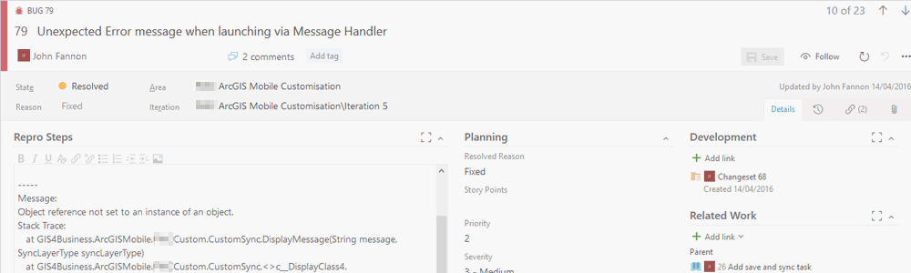
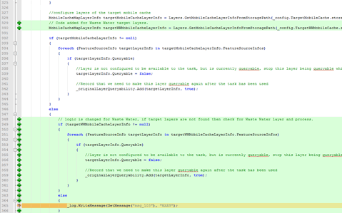
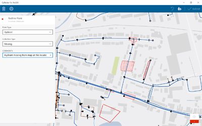
- ArcGIS Mobile including mobile customisations and integration with IFS;
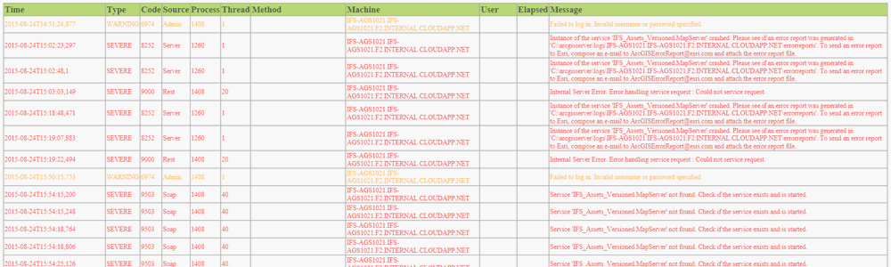
- Back-end scripts, processes and services that support the integration with IFS;
- Deployment of minor changes and regular data maintenance;
The agreement with Portsmouth Water encompasses the specific use-cases and work flows in which the overall solution is utilised. We have worked together with Portsmouth Water and third-party suppliers to track and resolve bugs and issues and provide strategic and technical GIS advice.
Our ongoing GIS support allows Portsmouth Water’s own staff to focus on core responsibilities, such as capturing, managing and updating their asset information, planning future asset improvements and reporting internally and externally.
“Our 8 years of working with GIS4BUSINESS has been and continues to be very positive, with successful completion of upgrades, various projects, customisations and training.”
Related Projects
SAP Work Manager Integration
Design review, code review and support during development and testing from GIS4BUSINESS enabled Accenture and Severn Trent Water reduce the risk involved in making code changes to an existing ArcGIS Mobile solution.
Mobile GIS for the Field
GIS4BUSINESS provided technical GIS consultancy including feasibility, design and development as part of the delivery of a replacement mobile GIS solution for over 1700 field users within Severn Trent Water.
Utility GIS Migration
GIS4BUSINESS completed the migration of an existing Esri ArcGIS 9.2 system to version 10.1 for Brookfield Utilities, a multi-utility client that install and manage gas, electricity, water and fibre networks.
Related Products & Services

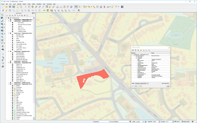
QGIS Desktop
QGIS Desktop is a professional GIS application that supports a wide variety of data formats and a growing set of features and functionality for creating, editing, visualising and analysing geographical information. QGIS has great support for OGC standards and has a range of plug-ins available.
Esri ArcGIS Online
Esri ArcGIS® Online is a fully hosted cloud-based mapping platform for creating and sharing GIS data, maps and apps that can be consumed on a variety of devices. The solution is scalable, secure and requires no investment in expensive server infrastructure.
Mobile GIS Services
Using mobile GIS can streamline data collection and update workflows and provide timely information about assets, vehicles or resources. GIS4BUSINESS can help you make sense of the options and help design, configure and develop mobile GIS solutions.
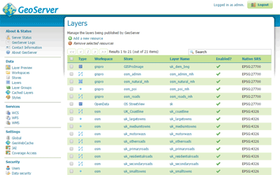
GeoServer
GeoServer is an OGC compliant server for publishing maps and spatial data using open standards such as Web Feature Service (WFS), Web Map Service (WMS) and Web Coverage Service (WCS).
System Integration
Increasingly location is embedded into business systems where visualising and analysing data requires system integration. GIS4BUSINESS has undertaken many projects involving integration of GIS functionality with other business systems.
Desktop GIS
GIS4BUSINESS can advise on the appropriate desktop GIS software to meet your requirements and provide commercial or open source GIS products. We can assist with installing the software, setting up your database and configuring your maps, layers and print layouts.